NE Georgia Drone Service Provider

Residential & Commercial Aerial Mapping & Imaging
Capture precise aerial data for residential and commercial properties with high-resolution mapping and imaging.
Our advanced drone technology provides detailed topographic maps, site documentation, and property overviews—ideal for real estate, construction planning, insurance assessments, and infrastructure management.
Whether you need accurate land surveys or visual property records, Mountain Hawk delivers reliable, cost-effective solutions tailored to your needs.
Precision Aerial Solutions for Georgia & North Carolina
Serving industries across Northeast Georgia and Western North Carolina, we deliver high-resolution aerial imaging and mapping tailored to your needs. Whether capturing critical infrastructure, monitoring construction progress, or providing detailed site assessments, our cutting-edge drone technology ensures accuracy, efficiency, and cost savings.
Proudly serving Habersham, Rabun, Towns, White, Hall, Banks, Stephens, Franklin, Hart, Madison, Elbert, Jackson in Georgia and Clay, Cherokee, Jackson, Transylvania in North Carolina.
Missions Flown
Flight Hours
Drone Services

Cell Tower Mapping
Capturing high-resolution imagery of cell towers to provide detailed visual data for owner analysis, digital twin creation and decision-making.

Construction Progress Monitoring and Volumetrics
Photogrammetry and 3D modeling for tracking construction progression and calculating volumetric measurements.
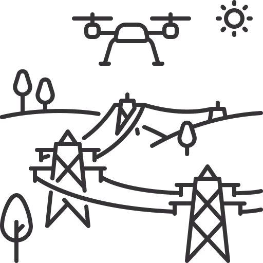
Utility Pole Inspection Services
Includes high-resolution imagery, thermal imaging, and 3D modeling for structural assessments and hardware diagnostics.

Custom Flight Plans
Tailored aerial solutions designed to meet your specific needs. From specialized imaging to precision mapping, we customize flight paths for optimal data capture and efficiency.

Capture high-resolution aerial imagery and data for cell towers, utility poles, and transmission lines. Our advanced drone technology provides detailed visual records, and 3D models to help clients assess structural conditions, identify potential issues, and streamline maintenance planning.

Hassle-Free Drone Operations
Fully Licensed & Insured
At Mountain Hawk, we handle everything—so you don’t have to.
Our FAA authorization allows us to legally operate drones over golf courses, residential areas, and commercial properties, ensuring full compliance with aviation regulations.
For business owners, managers, and superintendents, this means zero liability on your end.
We take on all legal responsibility for drone operations, backed by comprehensive insurance covering injury, property damage, and equipment use.
By working with us, you avoid the costs and complexities of:
✔️ FAA Part 107 certification
✔️ Compliance with drone flight regulations
✔️ Expensive drone equipment and software
✔️ Hiring and training drone operators
Mountain Hawk handles it all—so you can focus on what matters most.


Delivering precision aerial solutions using state-of-the-art equipment, proudly serving Northeast Georgia and Western North Carolina. Fully licensed and insured. FAA Certified 14 CFR Part 107.
Services
Engineering & Surveying Inspections
Construction Progress Monitoring and Volumetrics
Utility Pole Inspection Services
Golf Course Health Analysis
Aerial Photopgrahy and Videography
Let’s Review Your Flight Plan
Your mission demands precision, innovation, and expertise. Share your details in the form or call, and let’s create a plan that elevates your project to new heights.